WHY THE LANDSCAPE LOOKS THIS WAY
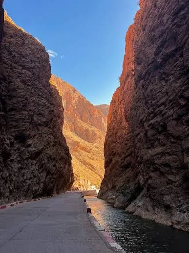
The formations are not isolated monuments. They belong to a larger system of ravines, riverbeds, slopes and cultivated ground. Seen from a path, their scale becomes clearer: narrow channels sit close to open views across the valley.
The terrain is visually dramatic, but it also asks for attention. Loose surfaces and confined passages make local route knowledge useful, particularly when conditions have changed.
AIT OUGLIF, AIT SDRAT AND THE CULTIVATED VALLEY
Aït Ouglif and Aït Sdrat are part of the lived geography around the formations. Earthen buildings, gardens and water systems show how settlement responds to the valley floor while the rock rises sharply around it.
Walking here connects the famous formations to the villages and cultivated land that give them context. It is more revealing than treating Monkey Fingers as a single roadside photo stop.
CHOOSING A MONKEY FINGERS EXPERIENCE
HIKE DADES offers several experiences in this area, each presenting a different relationship between canyon passage, village landscape and wider gorge views. Choose according to the kind of terrain and depth of exploration you want, then confirm current details directly before the walk.