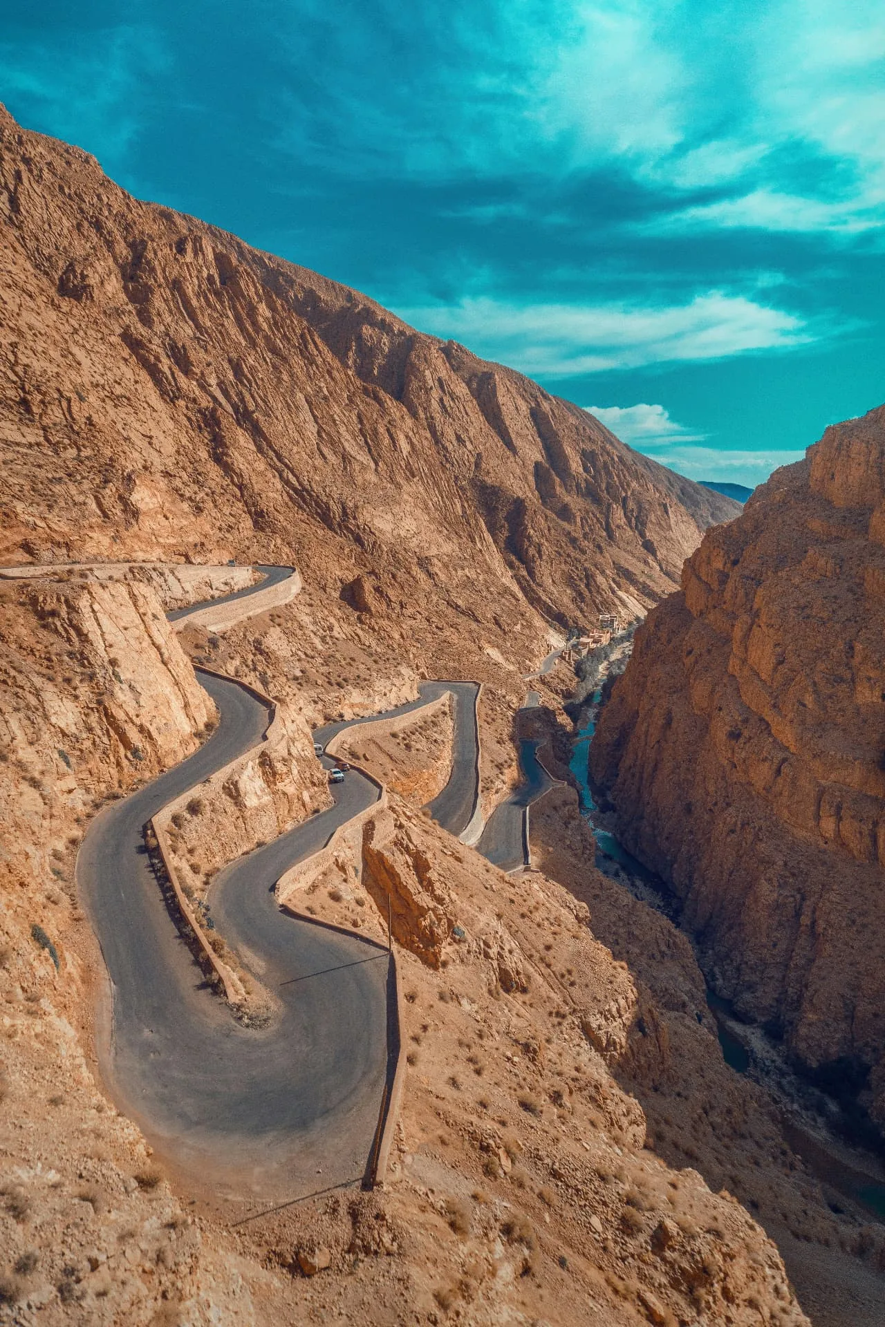
Tissadrine road winding through the ochre mountains of Dades Valley
HIGH ATLAS · MOROCCO

THE LAND BEHIND THE TRAIL.

THE VALLEY IS A CORRIDOR BETWEEN WORLDS.

The Dadès River cuts through the southern slopes of the High Atlas, creating a sequence of cultivated valleys, narrow gorges and exposed rock. Boumalne Dades is the principal gateway; from there, the road follows water and settlement toward the upper gorge.

Near Tamellalt, erosion has shaped conglomerate cliffs into the vertical forms known as the Monkey Fingers. Nearby villages, including Aït Ouglif and Ait Arbi, sit between these formations and irrigated gardens.

GEOLOGY IN MOTION

THE GORGE

Water, sediment and uplift have made a landscape of compressed contrasts: sheer walls beside small fields, dry slopes above river gardens, and narrow passages opening suddenly into broad views.

ARCHITECTURE GROWN FROM PLACE.

Traditional kasbahs and village houses use local earth, stone and palm wood. Their color is not applied from outside; it belongs to the material itself. The result is a built landscape that appears to rise directly from the valley floor.

The region’s Amazigh communities have long combined agriculture, livestock and trade. Seasonal movement between valley and mountain remains part of the cultural memory of the wider region, even as drought and changing livelihoods place pressure on nomadic practice.

ORIENTATION

AIT OUGLIF
TO AIT SDRAT.

An interactive Google map shows the roads, river corridor and villages that define the HIKE DADES activity area.

01

BOUMALNE DADES

31.374° N · 5.996° W

Gateway town to the valley and the road north into the gorge.

02

AÏT OUGLIF · MONKEY FINGERS

31.449° N · 6.024° W

Village paths, eroded formations and canyon passages near Tamellalt.

03

AÏT SDRAT

31.407° N · 6.012° W

A cultivated village landscape along the Dades Valley route.

04

KASBAH AIT ARBI

31.454° N · 6.017° W

Earthen architecture, gardens and views toward the rock formations.

05

TISSADRINE

31.530° N · 5.927° W

The stair-like mountain bends above the Dades Gorge.

06

DADES GORGE

31.583° N · 5.900° W

A narrow river canyon framed by high red and rose rock walls.

OPEN IN GOOGLE MAPS
LOCAL CULTURE

LAND IS NOT
SCENERY ALONE.

The valley is worked, inhabited and remembered. A responsible walk pays attention to gardens, water systems, village privacy and the knowledge carried by local guides.

EXPLORE OUR HIKES
READ THE DADES JOURNAL